The Map Does Not Show the Whole Shore
A coastal map can hide access, scale and local context. Learn how to read its symbols and limits before drawing conclusions about the shore.
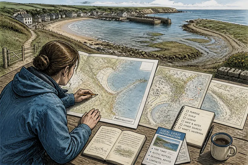
What does a coastal map leave out when you use it to decide what the shore is like? A coastal map can make a public beach, a working harbour and a tidal inlet look like neighbouring shapes on one sheet, while concealing the very differences that matter. The trouble is not that maps are useless; it is that their neat edges invite conclusions they were never designed to support.
Read a map as a particular account of a place, not as the place itself. When a detail seems decisive, check the scale, legend, date and source before deciding what it means on the ground.
Scale hides detail
A map at a broad regional scale has to simplify. A narrow path may disappear, a small beach may merge with the shoreline, and a sea wall may be shown as a single line. At a closer scale, those features may be drawn separately, but even a detailed sheet has to choose what deserves space.
This becomes a problem when readers compare places or infer that a blank stretch has no public value. The blank may mean only that the map was made for a different purpose, or that the feature was too small to include at that scale.
Check the scale bar and look for a larger-scale map of the same area. If a path or access point matters to your question, do not infer its absence from a regional overview.
Symbols flatten use
Map symbols compress complicated places into marks that can be recognised quickly. A harbour icon may indicate a facility without showing where commercial operations end and public access begins. A line marked as a footpath does not, by itself, tell you whether the route is open year-round, affected by tides or accessible to every visitor.
The legend is the first place to look, but it is not a full description. Check the map’s stated purpose and the organisation that produced it. A navigation chart, an access map and a planning map may depict the same shore differently because each is answering a different question.
Keep the symbol’s meaning narrow. Treat a path mark as evidence that a route is mapped, not as proof of its current condition or public status.
Edges invite false certainty
A coastline appears to be a clean boundary between land and water. In practice, tides, saltmarsh, mudflats, shingle and seasonal water levels complicate that line. The boundary may represent a survey convention or a particular water level rather than the visible edge on the day someone visits.
That difference can distort everyday claims. A map may show a broad area of land beside the sea, yet omit how much of it is submerged at high tide or difficult to cross after rain. Conversely, water may cover a foreshore on the map even though it is exposed for part of the tidal cycle.
Look for notes about tidal datum, survey conditions or the type of shoreline shown. Where access depends on the tide, consult local tide information rather than treating a static line as a timetable.
Missing context matters
Maps often show physical form more clearly than social arrangements. A beach may be visible while a seasonal gate, a customary gathering place or a contested access route is not. Those details can sit in council notices, local access information or planning documents rather than on the map itself.
Imagine you are comparing two mapped coves to decide which one offers public access. One map shows a track reaching the water at each cove, but neither records a seasonal closure. Check the relevant council notice and current site information; the useful result is a comparison based on access conditions, not merely on matching lines.
For a decision about public access, pair the map with the local authority’s current information and, where relevant, the site operator’s notices. A map is a starting point for locating the question, not a substitute for the answer.
Why does the map mislead?
Why does the coast look different on two maps?
Maps may use different scales, survey dates, shoreline definitions or purposes. Compare their legends and source notes before treating the difference as a change in the coast.
Does a mapped path mean public access?
Not necessarily. A path symbol can identify a route without establishing its current access rights, opening conditions or suitability for a particular visitor.
What does a blank coastal area mean?
It may mean the area was outside the map’s purpose or detail level, rather than empty or unimportant. Check a more detailed map and local records before drawing that conclusion.
Which map should I use for a public decision?
Use the map suited to the question: an access map for routes, a planning map for proposals, or a chart for navigation. Then consult current local information for conditions that a static map cannot represent.
Read the map in order
When a map seems to settle a dispute or answer a practical question, work through its limits before relying on it:
- Identify its purpose. Read the title and source. If it is a navigation chart, do not assume it was made to describe public access.
- Check the scale. Decide whether it can show the small features relevant to your question. If not, seek a closer-scale map.
- Read the legend. Find out what each line, colour and symbol means, and note categories that the legend does not define.
- Check dates and notes. Look for survey information, tidal references, revisions and stated limits. If the map is old or silent on conditions, verify them locally.
- Compare another source. Use a relevant authority notice, access record or site information to check what the map cannot establish.
- State the limit clearly. Say what the map depicts and what remains uncertain. This is more useful than presenting a symbol as a complete account.
Separate evidence from inference
A map can show a route, an edge or a named place. It may not establish who can use that route, how conditions change through the day, or what a proposed boundary means for nearby communities. Those are separate claims and may require separate sources.
In public discussions, this distinction helps keep disagreements focused. Rather than saying “the map proves access,” specify that it depicts a path, then identify the local record needed to establish access. The wording may be less dramatic, but it gives everyone a clearer question to answer.
The map does not show the whole shore because no single drawing can carry every physical, legal and social detail at once. A coastal map becomes more useful when you ask what it was made to show, notice what its symbols leave unresolved, and check the missing context before acting on its picture.